SPYLARK THREE PEAKS WALKS
One of the best things you can do to explore any new area is go for a walk. The Spylark walks each tackle one of the three peaks that features prominently in the story story. Each circular walk provides stunning views of the northern end of the lake at any time of year. The walks are best done with the Ordnance Survey map of the South Eastern Lake District, OL 7. Failing that, a drone is a great help if you lose your bearings.
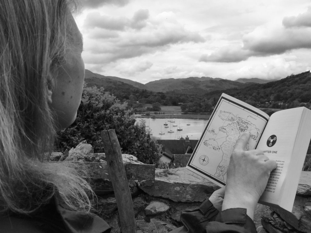
Each of the walks include a sketch map of the route, but you should also use the OL 7 (South Eastern) OS 1:25,000 map to find your way. There are PDF instructions to print off and take on your walk below. The walks also include some digital waypoints using the what3words app to help you check your location at key points.
Why let Danny know how you got on, or send him a photo on the summit via his Twitter or Instagram accounts. If you do that for all three walks Danny will send you a certificate of achievement!
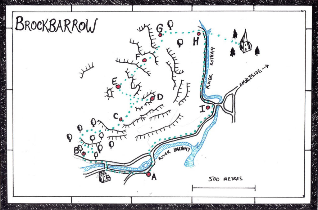
Walk 1: Brockbarrow (Todd Crag)
Brockbarrow is the steep, craggy hill behind Tom Hopkin’s house at the head of the lake. It was on this hilltop, that Tom first saw Maggie and Joel Green, while spying on Rufus Clay, before being persued by Squadron Leader Richard Riley in his Puma helicopter.
Distance: 3 miles
Start: The Brathay Trust has a car park available for public use, in exchange for a donation towards their work with disadvantaged children.
| Three words digital address | Coordinates | Ordnanace Survey Map |
| ///shun.tables.sake | 54°25’16.7″N 2°58’44.1″W | OL 7: NY365034 |
(Alternatively, if coming from Ambleside, turn off the A593 onto the B5286 and immediately on the right after the bridge there is some free parking.)
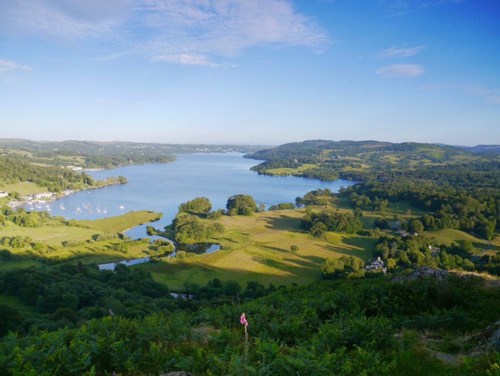
Summary: A short, steep climb through deciduous woods on good paths, rewards you with exceptional views over Windermere. Half way round there is an optional detour into Rothay Park which has one of the best playgrounds in the Lake District.
Spy: In the woods look out for squirrals, red deer and carpets of blue bells in the Spring. From the summit see if you can spot the Teal making its way gracefully down the lake towards ‘Birthwaite Bay’, (real name: Bowness) and the islands. And make sure you keep an eye out for RAF helicopters!
1. From the Brathay Trust car park (A) carefully cross the road to the River Brathay, turn left and proceed along Bog Lane with the river on your right until you reach Holy Trinity Church on the left. (Tom hid behind the towers of this church when being chased by the helicopter).
2. Cross the river by the stone footbridge. (Look out for great crested grebes and suspicious-looking kayakers!). Turn left and proceed carefully along the road for a few yards until you re-join a footpath that takes you past some Scots pines on a grass verge.
3. At a house called Pool Foot, carefully cross the road and turn right, following the footpath sign into Fishgarth’s Wood. (B) Following the yellow arrows, keep to the main path that winds up through the wood. As you climb, look right to see tantalising glimpses of the lake through the trees. Near the top of the wood, take the right side of a clear fork, and head towards a small gate.
4. Go through the gate (C) and you will see a dramatic view of the lake stretching out to the south. You could catch your breath, or even have a snack of some Kendal Mint Cake on the bench. But don’t linger too long as the views will get even better as you continue.
5. Leave the view point and take the left side of the fork, heading up hill. When the footpath surface changes to short grass, bear right. Look out for the Herdwick and Swaledale sheep which keep the crass nibbled short.
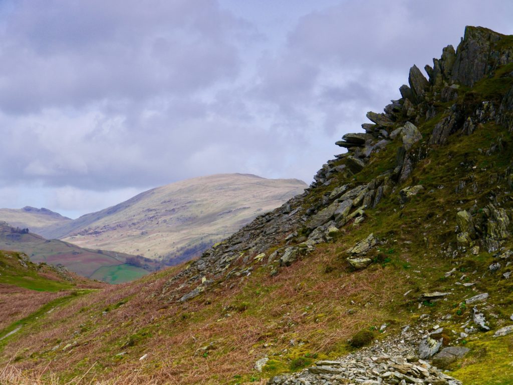
6. There are various small peaks and crags on the summit of the hill and you will soon reach the first, flat-topped, view point. The actual Todd Cragg is a little to the west of this. However, with the lake on your right make your way towards a jaggardy lump, with an array of rocks that look like the back of a stegosaurus. (D) Enjoy scrambling up the clear rocky path to the top.
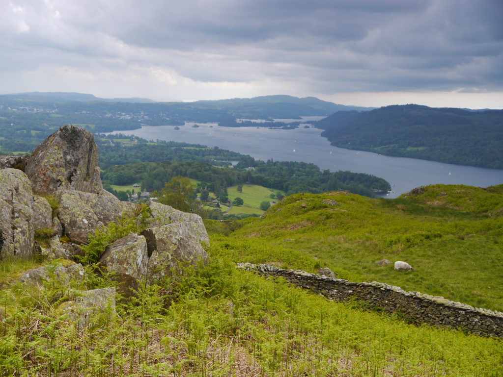
7. This is Brockbarrow! Unlike in Spylark, there is no trig point, but there are spectacular views of the lake stretching down to the islands in the middle. Directly below you should be able to spot Aunt Emily’s house, “Cedar Holme”, on the crook of two rivers, with its own little harbour. Using a map, see if you can work out which of the many hills are the other two which, together with Brockbarrow, form Rufus Clay’s deadly triangle of attack. These are Raven Howe (real name: Wansfell) and Rigg Knott (Latterbarrow). If you look carefully into the shadows of the wooded hills over the water towards Latterbarrow, you may be able to make out the imposing battlements of Blythe Castle (Wray Castle).
8. With your back to the lake, bear right down a steep path and pick up the main broad grassy path that leads through the bracken and around a small triangular tarn. (E) (There are lots of paths to explore on this flat part of the hill. If you don’t see the tarn, don’t worry, just keep heading in a roughly easterly direction until you see a stone wall).
9. At the stone wall go through a kissing gate (F) and descend towards the wood, with Watertop (Ambleside) in the valley below.
10. Cross the stream on a wooden footbridge (G), go through the woods for a short distance, and then take the steps over a wall onto a steep concrete track heading down towards the town.
11. At the bottom turn right onto a tarmac road towards a pretty hump-backed bridge over the river Rothay (H). If you have time you can take a detour over the bridge into Rothay Park, where you will find a fantastic playground. Beyond that is the village with plenty of chip shops, cafes, toilets, the famous Bridge House and also Fred’s independent bookshop, which used to be frequented by Swallows and Amazons author, Arthur Ransome.
12. Walk along the quiet road with the river on your left until you reach the A593, signposted Coniston and Skelwith Bridge (I). Cross the road and turn right on a footpath that leads to a left turn over a bridge signposted Hawkshead. Carefully follow the road for a few yards to return to where you began.
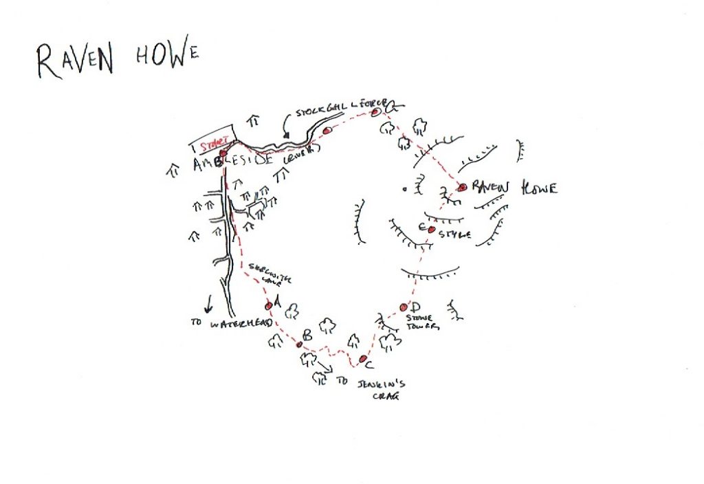
Walk 2: Raven Howe (Wansfell)
Raven Howe is where it all begins. This is the craggy fell on the east side of the lake from the summit of which Tom first sees Rufus Clay with his lap top, and witnesses the sinking of the Clementine. Despite its modest height it provides spectacular views towards the Troutbeck valley from one side and the entire northern half of Windermere from the other.
Distance: 4.5 miles
Start: Kysty, Cheapside, Ambleside
There are plenty of parking options and public transport links in Ambleside, including the option of a trip down the lake from Bowness on the famous Teal,disembarking at Waterhead. Thewalk begins at our family’s favourite place to eat in Ambleside, Kysty, which is Cumbrian dialect for ‘fussy about food’!
| Three word digital address | Coordinates | Ordnance Survey Map |
| ///overtime.dorms.sticking | 54°25’53.5″N 2°57’42.4″W | OL7 376 045 |
Summary: Wansfell (1588ft / 484m)is a popular walk, usually undertaken from Troutbeck, or straight up the steep northwest side from Ambleside. This short, circular walk, however, approaches the fell by an unusual route, following some rarely trodden paths on the ascent through the delightful Skelghyll wood. Because some paths are a little vague, navigational waymarks have been provided at key points.
Spy: In Skelghyll wood look out for red squirrels, enormous trees and – in winter – glimpses of the lake through the trees. From the summit see if you can see the other ‘Spylark Three Peaks’, Brockbarrow (Todd Cragg) and Rigg Knot (Latterbarrow). And keep an eye out for suspicious men with straw hats!
1. From Kystyhead down to the main road (Lake Road) and turn left. Then bear left up Old Lake Road. A little later take another left, following a rusty footpath sign for ‘Jenkin’s Crag and Troutbeck’.
2. Walk up the steep tarmac lane, then take the right fork signposted ‘Jenkins Cragg, Broad Ings and Skelghyll Woods’.
3. At the next fork take the right hand path signposted ‘Skelghyll woods,’ (Broad Ings left). (A) There is bench here with views over the river Brathay.
3. When you reach the National Trust sign for ‘Skelghyll Woods’ (B ) you could – if you wish – take a right hand path for a detour that leads to the delightful Stagshaw Gardens, noted for their collection of rhododendrons and azaleas.
4. At the next fork turn left, following the bridleway sign. Look out for some very large Douglas Firs. Keep on the track that crosses the beck over a little bridge.
5. Look out for a narrow left hand path leading away from the main path signposted ‘National Trust: Keswick Fell, (C). If you reach the Jenkins Crag view point you have gone too far.
6. Head up the fellside into the woods, bearing left, and ignoring a right hand fork, past a large rock formation on your right. Proceed up the hill, ignoring a left hand fork, and following a right bridleway sign. Eventually you will come to a drystone wall. Climb over the wall via a ladder stile and emerge into open moorland.
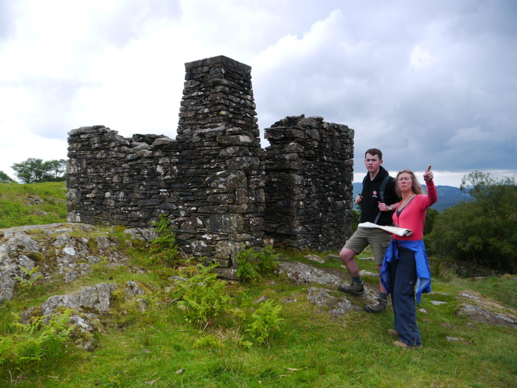
7. Pass an interesting stone pillar and enjoy the view. (D). The path then winds up through the bracken heading towards the fell, with the stone wall on your left. The path is generally clear, and there are white arrows pointing the way.
8. Eventually you will cross another ladder style at the three word address: generals.decisions.lentil. (E)
9. The summit (F) (fruity.maddening.lawns) offers fantastic views of the lake, and the town of Ambleside (Watertop) below. There is no actual trig point here but this is where Tom first spied Rufus clay with his lap top.
10. Leave the summit and go through a kissing gate. The path down is good, clear but very steep in places, and slippery in the wet. After a while it levels off beside the stream with meadows on either side. Listen out for cuckoos in the spring.
11. Go over a stile to join the tarmac road (G) that leads down to the town. Soon there is a path right through an usual turnstile gate that will lead you down past the waterfalls of Stockghyll. Eventually this will take you back to the town and the start.
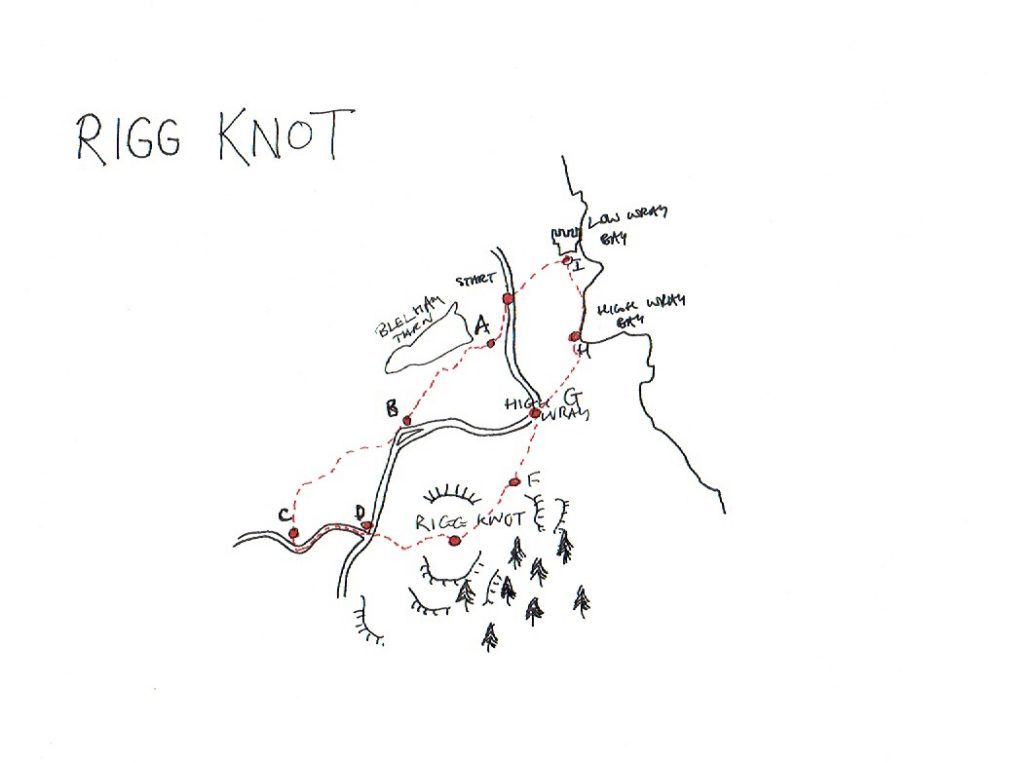
Walk 3: Rigg Knot (Latterbarrow)
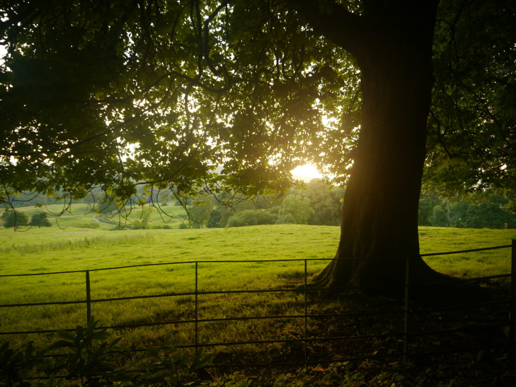
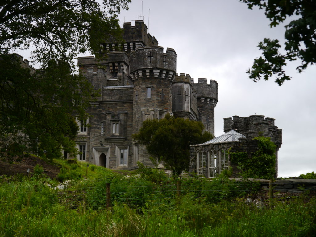
Rigg Knot, where Tom spots Victoria Juniper in Chapter 4 of Spylark,is described as ‘an even-sided hill surrounded by conifers, with a view of the whole northern quarter of the lake.’ This walk, on the quiet Western shore of Windermere, features Wray Castle (‘Blythe Castle’ in the book). The castle is an enormous ‘gothic revival’ structure (which means it’s not as old as it looks) and has been often criticised as out of place in its lakeland setting, including by the wife of James Dobson the Liverpool Surgeon who built it in 1840, who said she would never live it in, and by author Nathaniel Hawthorne who described it as a ‘great foolish toy’. But, along with Beatrix Potter who stayed there for holidays, we love it! With its turrets and towers and jackdaws keeping watch over its wooded grounds, it’s a wonderfully atmospheric place to explore at the end of the walk.
Distance: 5 miles
Start: Travelling from Ambleside, take a minor road off the B5286 signposted ‘Wray Castle’. Just after the entrance to the castle there is a layby on the right with parking for several cars. If this is full head into the castle where you can park in the National Trust pay and display car park The exact location can be found here:
| Three word digital address | Coordinates | Ordnance Survey Map |
| ///cocoons.asking.obstinate | 54.397838, -2.969640 | OL 7: NY 372 007 |
A nice alternative would be to get the ‘Green Cruise’ boat from Ambleside to the Wray Castle boathouse, and start the walk from there. https://www.windermere-lakecruises.co.uk/cruises-fares/green-cruise).
Summary: A varied and delightful walk at any time of year. Meadows and woodland paths, and a short, steep climb for fantastic views.
Spy: In summer look out for some spectacular wild flower meadows. On the climb up Latterbarrow alder trees predominate – look out for their catkins in the spring and small cones in the autumn. The castle has its own gothic style boat house with its own harbour which is well worth a look. And keep an eye out for mysterious ice cream vans in the car park!
1. From the layby walk south for about 250m along the road to a footpath sign pointing right. Follow the yellow arrows to a footbridge made of stone slabs. (A) (This is a good moment to play a quick game of Pooh sticks in the small stream).
2. The path continues, through a kissing gate, then another gate and into a field with a fence on your left. Cross a stile (look out for the special gate for dogs) and follow the sign-posted path, through some delightful fields and meadows, with views of Blelham Tarn on the right, until you reach some cottages. (B) (Beware of the small but hostile dog that snarled and snapped at us for the next mile!)
3. After the cottages continue on a tarmac road for about 100m and take a right turn towards a farm, followed in just a few steps by a left turn signed ‘Loanthwaite, Hawkshead, Outgate.’ (///stadium.shots.crank). Follow the signed path through more fields and through a number of gates and stiles to arrive at a cluster of buildings marked on the map as Loanthwaite. (C) (///tooth.gobblers.shining)
4. Take a left turn and walk up the tarmac lane, enjoying the views as the lane rises towards the road. At the T-junction with the main road, turn left, walk about 100m along the road and look out for a right hand footpath sign for Latterbarrow (D).
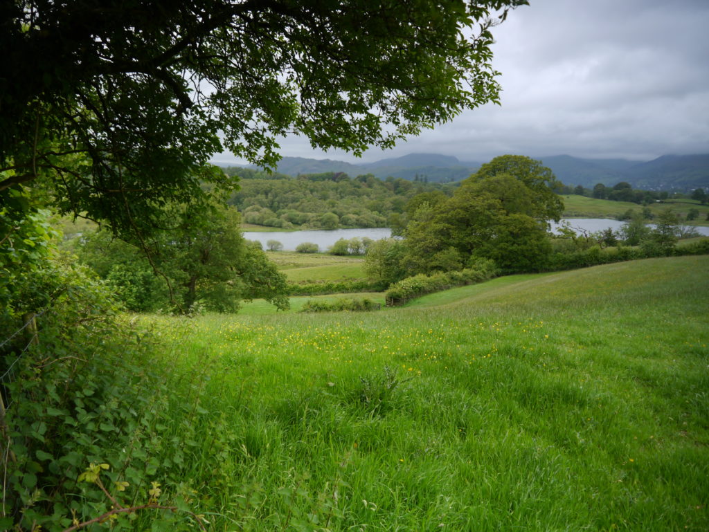
5. Follow the unmistakable path, easy at first, then steep, then easy again, all the way to the top, turning back occasionally to enjoy the expansive views towards Hawkshead, Grizedale Forest and the Coniston fells beyond. At the top there is no actual trig point, but a rather unusual stone monument marking the 244m (803ft) summit of Latterbarrow. Look out for the ‘lone runner doing some leg stretches’ (chapter 8) while enjoying the views of the lake, the fells and even Morecambe Bay to the south, (E).
6. Pick up the grassy path that leads down the hill, with the lake right in front of you. Go through a kissing gate into some woods, jump over a stream, over a stile, and arrive at a gate on a track opposite the National Trust’s Basecamp (///overlook.breeze.feast). (F).
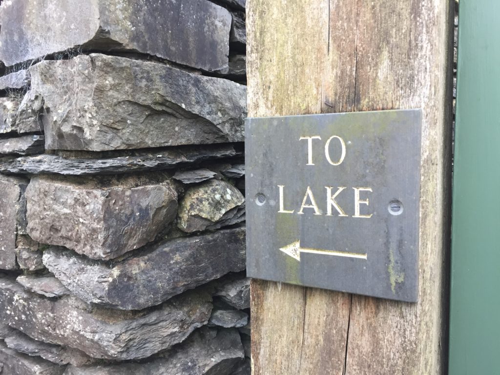
7. Turn left along the path which soon leaves the woods for open country until you reach the pretty hamlet of High Wray, (G). Turn right, go past a small road signed ‘Ferry’, and look for a house named ‘The Cottage’. Here you will find a footpath signed ‘To the lake’ which points over a stone stile. (///machinery.lunching.diets)
8. Follow the path through a field. (If you’re scared of cows, and there are cows in the field, the stone wall on your left will make you feel safe!) Go through a kissing gate and head down to the lakeshore at High Wray Bay, (H).
9. At the shore turn left and follow the fine path along the lake, passing through two gates, not missing the National Trust sign pointing you right into the grounds of the castle. Take some time to explore the castle grounds. (I) As you make your way back to the start along the drive way, enjoy the great views of the Langdale Pikes.