Explore
Explore Spylark Country
All of the action in Spylark is set in and around the northern half of lake Windermere, which is, in the opinion of the author, England’s most stunning lake as well as being its longest.
Following in the tradition of Arthur Ransome the Lake District’s most famous children’s author, some of the names have changed and one or two places have merged together. However all the locations in the book are based are real places. These include: the three peaks of Raven Howe, Brockbarrow and Todd Cragg, where Tom’s suspicions about Rufus Clay’s criminal activities are first aroused; the River Elleray on the banks of which Tom lives with Aunt Emily; the amazing Thirlmere Aqueduct; Blythe Castle; the islands of Ransome Holme and Benson Isle, and most importantly of all “the lake” itself.
The map which you will find in the front of the novel has been drawn by talented illustrator Finn Sorsbie, and is (pretty much) to scale. If you enjoy maps and you’d like to get to know this wonderful part of the world a bit better it is hard to think of a more enjoyable activity on a wet Sunday afternoon than seeing if you can work out the real names of some of the places in the book by comparing Finn’s map to the OS 1:25,000 scale or an online map.
If you get stuck, or have any other questions about Spylark, get in touch with Danny and he will do his best to answer your question.
If you’re in the Lake District – and don’t happen to have fast and sophisticated home-made tricopter drone to show you around – then you can get to know Spylark country first hand by going on one of these wonderfully enjoyable walks which each tackle one of the three peaks that feature prominently in the book. Why not let Danny know how you got on, or send him a photo via his Twitter or Instagram accounts.
Explore further:
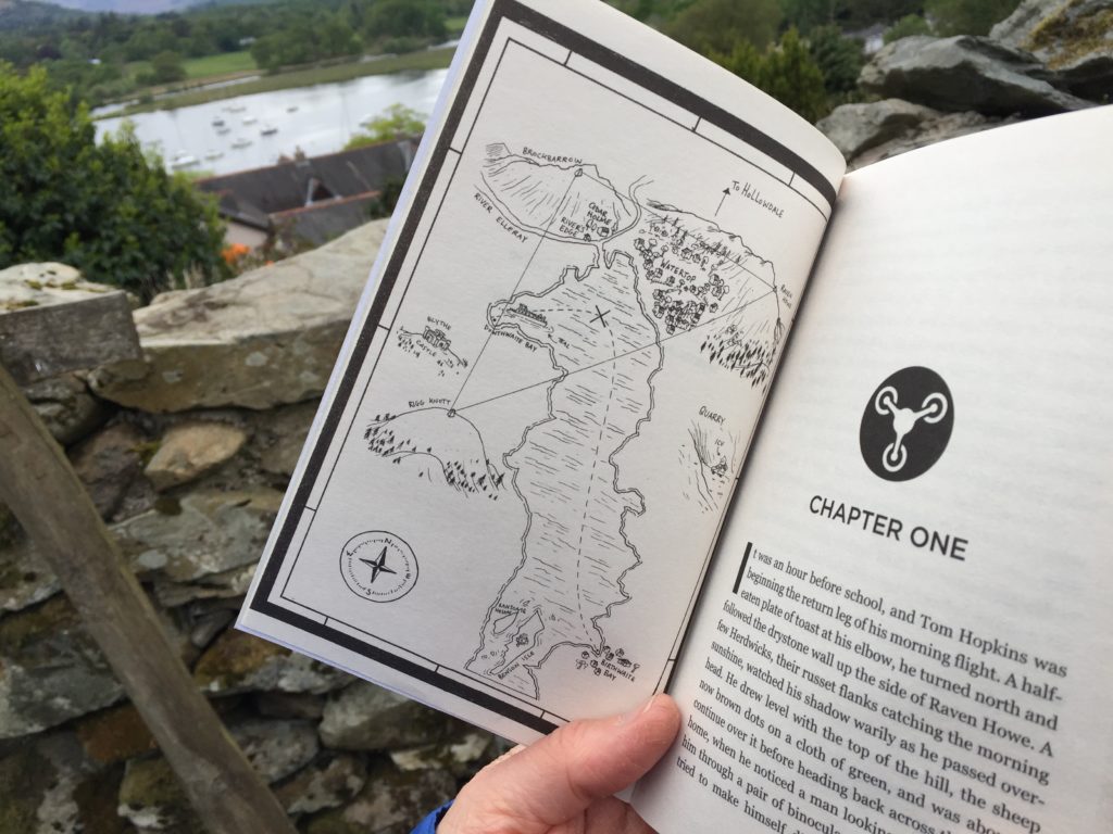
Map by Finn Sorsbie